
Services

Turning Data
Into Opportunity.

From aerial imagery to automation, we help you connect, understand, and put your data to work.

Different Data. A Clearer Future.

What We Do

Aerial imagery · GIS & spatial data · data engineering · automation · analytics & dashboards · custom software.

Data Engineering & ETL

Get your data where it needs to be.

Data center server racks
  • Data extraction, transformation & loading
  • Database design & optimization
  • PostgreSQL / PostGIS
  • Data validation & quality control
  • Integrations with multiple data sources
  • Automated data pipelines

GIS, Spatial Data & Imagery

Location is data. Imagery is data.
Aerial GIS imagery
  • Aerial & satellite imagery
  • Orthomosaic & imagery processing
  • GIS data processing & analysis
  • Spatial analysis & modeling
  • Raster & vector workflows
  • PostGIS, GeoServer, web mapping
  • Data conversion (shapefile, GeoPackage)
  • Derived data products (parcels, land cover)

Automation

Remove the repetitive. Focus on what matters.
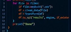
Python automation code
  • Process automation (Python)
  • Scheduled jobs & monitoring
  • File processing & data workflows
  • API integrations
  • Automated reporting
  • System health checks (servers, services)
  • Custom tools for your workflow
  • Save time. Reduce errors.

Dashboards & Analytics

Turn data into decisions.
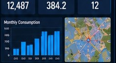
Analytics dashboard
  • Interactive dashboards (Power BI)
  • Custom metrics & reporting
  • Geospatial visualization
  • Role-based access
  • Embed in your existing systems
  • Turn complex data into clear insights
  • Help your team make better decisions
From Imagery to Data

More Than a Picture.

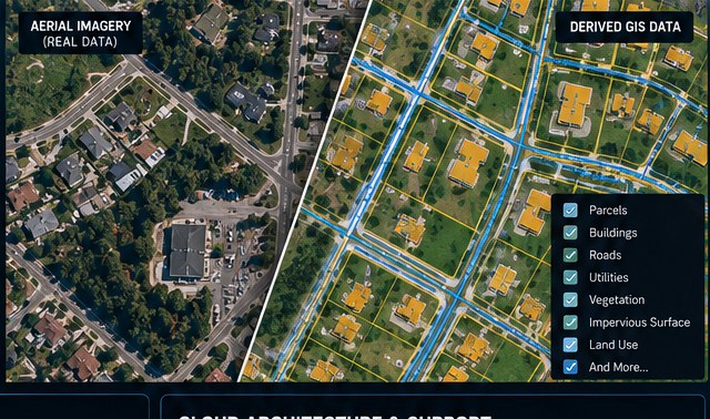
Aerial and satellite imagery isn't just a pretty picture — it's a powerful data source. We process, analyze, and derive real-world information from imagery to help you see more, understand more, and do more.

  • Identify and map features
  • Derive parcels, buildings, and infrastructure
  • Analyze land cover, vegetation, and impervious surfaces
  • Measure change over time
  • Integrate with your existing GIS and databases
  • Turn imagery into actionable data
Let's Unlock Your Data
Aerial imagery compared with derived GIS data — parcels, buildings, roads

Desktop & Custom Software

Tools built around your workflows.
Custom desktop software
  • Desktop applications (VB.NET, C++)
  • Custom data processing tools
  • GIS desktop tools (DotSpatial, QGIS)
  • Data management utilities
  • Simple, user-friendly interfaces
  • Built for your specific needs

Cloud Architecture & Support

Scalable. Secure. Practical.
Cloud server architecture
  • Cloud database setup (Azure, AWS, etc.)
  • Scalable architecture
  • Data storage & backup solutions
  • Server configuration & support
  • Web mapping & application hosting
  • Ongoing maintenance and guidance

Have a Data Challenge?Let's Figure It Out Together.

Start the Conversation