

Capability

Imagery →
Derived Data

Aerial and satellite imagery isn't just a picture — it's a powerful data source. We turn it into meaningful GIS data and insights you can act on.

← Back to Projects

What We Derive

See More.
Understand More. Do More.

We process and analyze imagery to extract the features that matter — then integrate them with your existing GIS and databases so they're immediately useful.
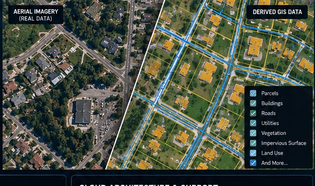
  • Parcels & property
  • Buildings & structures
  • Roads & infrastructure
  • Utilities
  • Vegetation & land cover
  • Impervious surfaces
  • Land use
  • Change over time
Aerial imagery compared with derived GIS layers

How We Work

Practical imagery workflows, built around the data and tools you already have.

Process

  • Orthomosaic & imagery processing
  • Aerial & satellite sources
  • Raster & vector workflows

Analyze

  • Feature identification & mapping
  • Spatial analysis & modeling
  • Change detection over time

Deliver

  • PostGIS, GeoServer, web mapping
  • Data conversion (shapefile, GeoPackage)
  • Integrate with your existing GIS

Have Imagery to Unlock?Let's Turn It Into Data.

Start the Conversation